Drone real estate photography can make a listing stand out, yet it is a regulated and technical job. This guide sets out the FAA rules as the agency publishes them, explains how to plan and shoot the pictures, and reviews what research says about visual media in property listings.
Aerial pictures show what a ground-level camera cannot: the size of the lot, the pool, the roofline and the neighbourhood. Drone real estate photography answers that demand, and many agents now ask for it. However, the work involves federal rules, privacy law and real safety risks. Online guides often promise large hourly earnings. We do not repeat those figures, because we found no reliable evidence for them.


Drone Real Estate Photography and the Law in the United States
The rules below describe the United States and were checked against FAA pages in November 2026. Other countries have different regimes, so check your own aviation authority first.
Part 107 or the Recreational Exception?
The FAA says recreational flying means flying “purely” for fun or personal enjoyment. Its own examples of non-recreational flights include taking photos to sell a property.1 Real estate work therefore falls under Part 107, which requires a Remote Pilot Certificate.
To earn that certificate you must be at least 16 years old and able to read, speak, write and understand English. You must also pass the FAA knowledge test at an approved testing centre and complete TSA security vetting. After that, you must complete recurrent training every 24 calendar months.2
Operating Limits That Shape Every Shoot
The FAA’s summary of Part 107 sets limits that matter on a property shoot. First, the aircraft must weigh less than 55 pounds and stay within visual line of sight. Second, it may fly up to 400 feet above ground level, or higher if it remains within 400 feet of a structure. Third, flights are allowed in daylight, or in civil twilight with appropriate anti-collision lighting.3 In addition, operations over people who are not directly participating are prohibited, unless the flight meets the FAA’s operations-over-people requirements.4 A family in the back garden is therefore a reason to wait, not to fly lower.

Night Flights and Registration in Drone Real Estate Photography
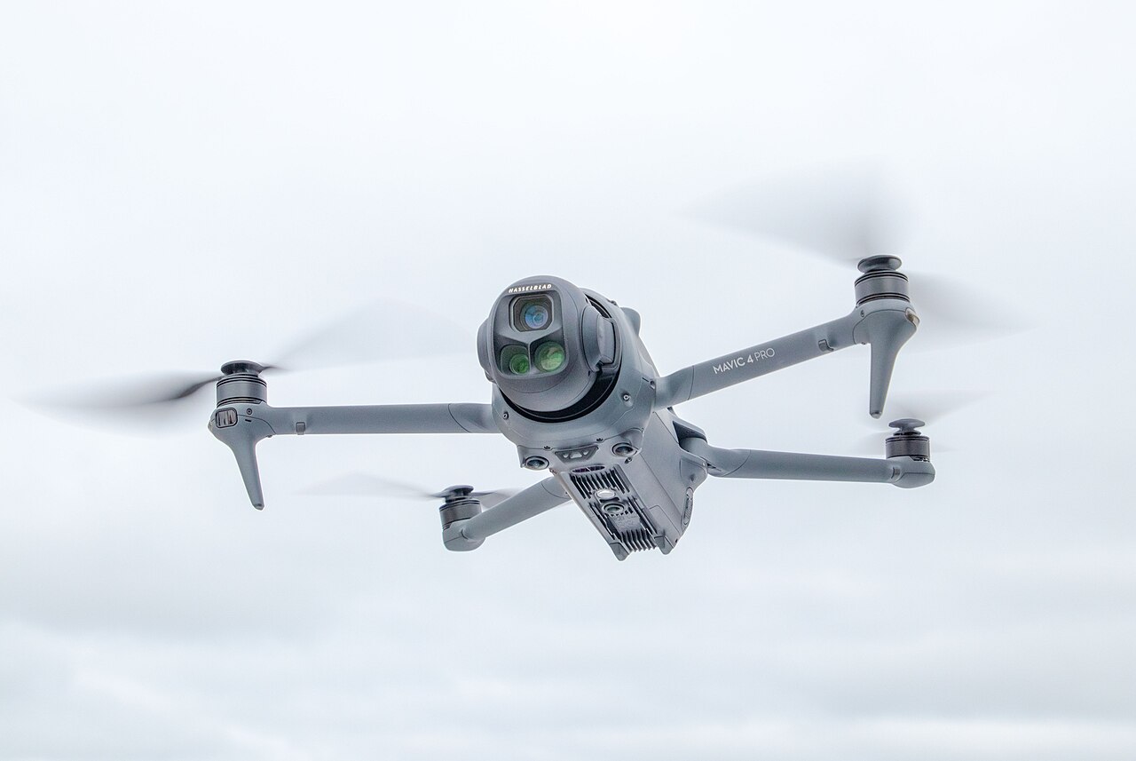
Since April 2021, Part 107 has allowed night flights without a waiver. However, the remote pilot must have completed the updated initial knowledge test or recurrent training, and the aircraft needs anti-collision lighting visible for at least three statute miles5. The same lighting rule applies in civil twilight, which the regulation defines outside Alaska as the 30 minutes before sunrise and after sunset. Night waivers issued earlier stopped permitting night flights after 17 May 20216. Controlled airspace still needs authorisation, as the airspace section below explains.
Registration is a separate step. The FAA lists a Part 107 registration at $5 per drone, valid for three years, and requires the registration number on the aircraft. In addition, a registration made under the recreational exception cannot be used for Part 107 flights7. Consequently, a hobby drone needs a new registration before paid work. TRUST, the free Recreational UAS Safety Test, is the FAA’s requirement for recreational flyers8. Paid work needs the Part 107 certificate instead.
Remote ID and Airspace Authorisation
Drones that must be registered also have to comply with Remote ID. For instance, they can do so as a standard Remote ID drone, with a broadcast module, or inside an FAA-recognised identification area. Part 107 pilots register each device separately.9
Airspace is the next question. Operations in Class B, C, D and controlled Class E airspace need authorisation. The FAA’s LAANC system gives near-real-time approval at pre-approved altitudes through approved service suppliers, and requests can be sent up to 90 days ahead. However, higher altitudes need extra coordination and at least 72 hours’ notice. At airports without LAANC, the manual route has historically taken up to eight weeks.10 As a result, always check the airspace before you quote a job, not after.
Part 108 and Flights Beyond Visual Line of Sight
In August 2025 the FAA and TSA published a proposed rule, “Part 108”, for flights beyond visual line of sight. However, it was only a proposal, not a final rule.11 We found no final rule in the Federal Register as of early November 2026. A trade report dated 2 November 2026 described the rule as still under White House review.12 For most listing shoots this changes little, because you fly in sight of the property anyway.
State and Local Law
The FAA controls aviation safety and airspace. According to its fact sheet, however, states and localities may generally regulate privacy, voyeurism, harassment and trespass, as long as they do not interfere with the airspace itself.13 In practice, get the owner’s written permission and avoid framing neighbours’ windows or gardens. This article is general information, not legal advice.

Where Drone Real Estate Photography Is Restricted
Some places are closed to drones whatever your certificate says. The FAA prohibits drone operations from the ground up to 400 feet above ground level over designated national security sensitive facilities. Its examples include military bases, landmarks such as the Statue of Liberty and Mount Rushmore, and nuclear power plants. It also notes flight restrictions or temporary flight restrictions over some public venues14.
National parks work differently. The National Park Service says Policy Memorandum 14-05 of June 2014 directed superintendents to use 36 CFR 1.5 to prohibit launching, landing and operating uncrewed aircraft, and that the memo remains in force with a few exceptions. Violations are misdemeanours with a maximum of six months in jail and a $5,000 fine15. Because the park’s authority ends at its boundary, ask the park before you plan a listing shoot near one.
The rules may also change. In May 2026 the FAA proposed a process under which operators of eligible critical-infrastructure facilities could petition for flight restrictions, generally up to about 400 feet above ground level within the property boundary. The comment period was extended to 5 August 202616. It is a proposal, not law, so check the FAA’s current pages before you rely on it.
Permission, Privacy and Insurance for Drone Real Estate Photography
FAA authorisation covers airspace, not access to the property. Therefore, get written permission from the owner or the listing agent. Tell neighbours when the flight path passes close to their homes. We found no authoritative source on homeowners’ association rules, so read the association’s documents instead.
Public worry about privacy is real. In a US interview study, Wang and colleagues reported concerns about drones’ inconspicuous data collection and hidden controllers17. A later survey found that people who use drones and know their regulations were less concerned18. For example, standing visibly near the site and explaining the flight may reduce alarm, although neither study tested that.
Insurance is a contract matter in the United States, as far as we could tell. The FAA pages we read stated no insurance requirement, but that is not proof that none exists, and clients often ask for cover. In the UK, the position is clearer: the CAA says flying for any purpose other than recreation, sport or hobby requires third-party insurance as a minimum19.
Drone Real Estate Photography Rules Outside the United States
Aviation law differs by country, so the American rules above do not travel. These two summaries are starting points, not a complete guide.
United Kingdom
The CAA says organisations flying for work must register as an operator and label each drone with its Operator ID. Drones under 250 g without a camera are generally exempt. Pilots need a Flyer ID, and the A2 subcategory also requires an A2 Certificate of Competency. Open category flights need no authorisation, whereas the Specific category requires an Operational Authorisation from the CAA20.
European Union
The EU open category sits under Regulation (EU) 2019/947. An EASA presentation summarises it as aircraft under 25 kg, flown within visual line of sight at no more than 120 m. It also divides flights into subcategories A1, A2 and A3 by distance from uninvolved people, and requires operator registration above 250 g or when the drone carries a sensor that can capture personal data21. However, the slides are old, and member states apply the rules through their own authorities. Therefore, check your national aviation authority before you fly.
What Research Says About Visuals in Property Listings
Do better pictures help a property sell? Two peer-reviewed studies offer evidence, though neither is a guarantee. Benefield, Cain and Johnson studied photographs in a multiple listing service. They found that the number and type of photos were associated with higher prices and with differences in marketing time.22
Evidence for Drone Real Estate Photography in Listings
A later study looked at Singapore from 2015 to 2018. Ong, Wong, Wang and Lai found that listings with a 360-degree virtual tour or drone video had higher buyer arrival rates, a higher probability of sale and higher selling prices. Listings with virtual tours were also associated with longer marketing time, which the authors link to information overload.23
Satellite Images and Virtual Tours
Other studies concern different visuals. Benefield, Cain and Johnson later examined satellite images and reported no effect on price, but a statistically significant positive effect on marketing time24. Anderson, Freybote and colleagues reported that virtual tours raised the sale prices of occupied homes, but not of vacant ones25. Among the studies we found, only Ong and colleagues include drone video, so the direct evidence on aerial pictures is thin.
What the Evidence Can and Cannot Show
These studies are observational. They show associations, not proof that a drone video caused a sale, and the markets differ. For that reason, avoid promising clients a price premium. It is more honest to say that aerial views add information that buyers value.
Planning Drone Real Estate Photography Shoots
Before You Fly
First, start with a clear brief: which pictures the agent needs and which features must be visible. Then walk the site and look for wires, tall trees, neighbouring buildings and any people. Check the forecast, since wind affects both safety and sharpness. Finally, run a preflight check. Section 107.49 requires the pilot to assess the weather, the local airspace and flight restrictions, and the people and property on the ground. The pilot must also brief everyone taking part, confirm that the control link works and that power is sufficient, and secure any attached object26. Checking the aircraft itself also protects your equipment.
Light and Timing
Soft, low sun gives roofs and gardens depth. Moreover, a short window around sunset can add warm windows against a deep blue sky. Remember, though, that flying in civil twilight requires anti-collision lighting, so plan this in advance. Our guide to the low light of the day’s edges explains why these hours flatter buildings.
Angles and Composition for Drone Real Estate Photography
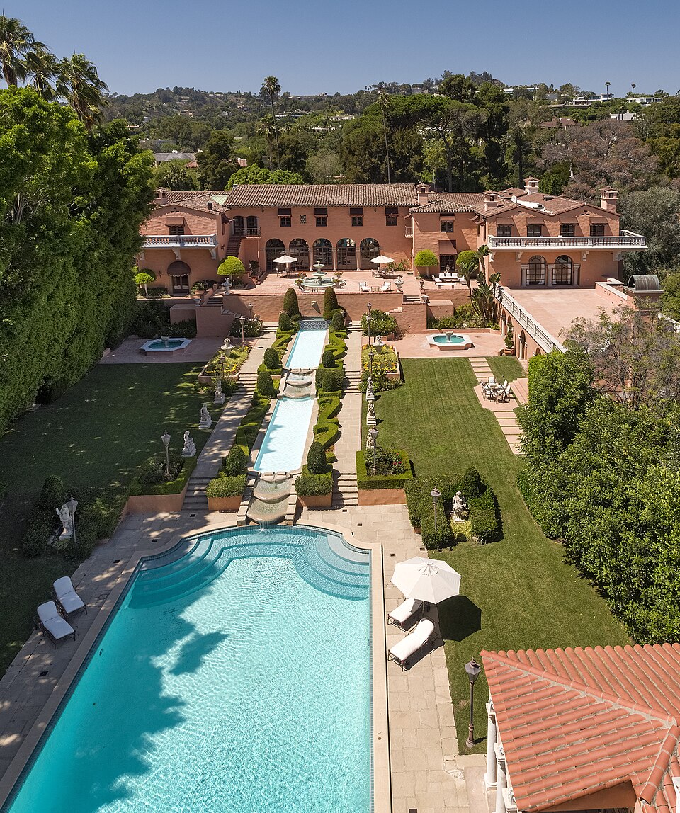
A small set of shots covers most briefs. First, a high oblique view shows the house in its setting. Second, a lower approach along the front gives the façade its character. Third, a top-down view reveals lot lines, a pool or a terrace. Also, keep the horizon level and avoid fisheye distortion at the edges. Above all, show the property as it really is, including the neighbourhood buyers will live in.

Camera Settings for Aerial Listing Photos
Shoot in RAW and fix the white balance, so that colours stay consistent across a series. Next, use a low ISO and a shutter speed fast enough to avoid vibration blur. For high-contrast scenes, take bracketed exposures while the drone hovers. In addition, neutral-density filters help when you also record video. Check the histogram in the air rather than trusting the small screen.
Editing and Delivering Drone Real Estate Photography
Overall, editing should make the pictures accurate and pleasant. For example, straighten horizons, balance colour and recover shadows. If you use layers and masks for local corrections, our guide to selective editing covers the method. For video, a clear colour workflow matters just as much, as the discussion of grading in DaVinci Resolve shows.
Do not remove power lines, neighbouring buildings or defects that a buyer would see in person. Such edits can mislead buyers and may break local listing rules, so check your MLS’s photo policy. If you use AI tools, our piece on generative fill and its limits is a useful warning. The broader role of images in selling is discussed in our analysis of photography in marketing.
Running a Drone Real Estate Photography Business Without the Hype
First, price your work from your real costs: time on site, editing, insurance, equipment and licensing. Ask each client about insurance requirements, and put the scope of the shoot in writing. Moreover, keep your certificate, registration and airspace approvals where you can show them. Those records protect you if a client or an authority asks questions.
Drone Real Estate Photography FAQs
Do I need a licence for drone real estate photography?
In the United States, yes. The FAA treats taking photos to sell a property as non-recreational, so Part 107 and a Remote Pilot Certificate apply27. Other countries have their own rules.
Can I fly a drone over someone else’s property?
The FAA regulates aviation safety and airspace, while states and localities may generally regulate privacy, trespass and similar matters28. We found no single national answer, so ask for permission first.
Can I fly at night for a listing?
Yes, since April 2021, if you have completed the updated training and the aircraft has anti-collision lighting visible for three statute miles. Controlled airspace still needs authorisation.
Do I need insurance?
We found no US federal requirement in the FAA pages we read, but clients may require it. In the UK, third-party insurance is the minimum for work. See the insurance section above.
Can I fly near an airport or in a national park?
Near airports, controlled airspace needs authorisation, usually through LAANC. In national parks, the National Park Service generally prohibits launching, landing and operating drones. See the sections above for details.
Do drone photos help a house sell?
The evidence shows associations, not proof. One Singapore study linked drone video and virtual tours to higher buyer arrival rates and prices, but its authors also note longer marketing time for virtual tours. Avoid promising a price premium.
Conclusion: Drone Real Estate Photography Done Properly
Good drone real estate photography combines three things: legal compliance, careful planning and honest editing. Hold a Part 107 certificate, check the airspace, respect people and property, and keep your claims modest. Done this way, drone real estate photography gives listings real information, and it keeps you on the right side of the rules.
Sources and Limits
We did not retrieve several sources, so this article does not cover them. They are MLS and brokerage photo rules, homeowners’ association rules, state trespass and privacy statutes and case law, the US insurance market, pricing evidence, current EASA class marks and national rules, and the Federal Register texts of the Part 108 and Section 2209 proposals. We also did not read 14 CFR 107.15 or the FAA’s full airspace maps. Therefore, treat the article as an orientation, not as legal advice.
Several research findings rest on summaries, not full texts, and the DOI checks confirm only that the papers exist. In addition, we did not inspect competing guides, so we make no claim about how this article compares with them.
- FAA, “Recreational Flyers and Modeler Community-Based Organizations”: https://www.faa.gov/uas/recreational_flyers. The page advises: “When in doubt, assume Part 107.”
- FAA, “Become a Certificated Remote Pilot”: https://www.faa.gov/uas/commercial_operators/become_a_drone_pilot.
- FAA, “Summary of Small Unmanned Aircraft Rule (Part 107)”: https://www.faa.gov/uas/media/Part_107_Summary.pdf.
- FAA, “Operations Over People General Overview”: https://www.faa.gov/uas/commercial_operators/operations_over_people.
- FAA, “Operations Over People General Overview”. (FAA)
- 14 CFR 107.29, Operation at night. (14 CFR 107.29)
- FAA, “Register Your Drone”. (FAA)
- FAA, recreational flyer knowledge test page. (FAA)
- FAA, “Remote Identification of Drones”: https://www.faa.gov/uas/getting_started/remote_id.
- FAA, “Part 107 Airspace Authorizations”: https://www.faa.gov/uas/commercial_operators/part_107_airspace_authorizations.
- Federal Register, “Normalizing Unmanned Aircraft Systems Beyond Visual Line of Sight Operations,” 90 FR 38212, 7 August 2025, docket FAA-2025-1908: https://www.federalregister.gov/documents/2025/08/07/2025-14992/normalizing-unmanned-aircraft-systems-beyond-visual-line-of-sight-operations.
- FlyCRE, “BVLOS Rule Due December 7: What Part 108 Means,” 2 November 2026 (trade source, not an official one): https://www.flycre.com/blog/bvlos-rule-part-108-orange-county.html.
- FAA, “State and Local Regulation of Unmanned Aircraft Systems (UAS) Fact Sheet”: https://www.faa.gov/uas/resources/policy_library/UAS_Fact_Sheet_2023.pdf. The National Conference of State Legislatures also publishes an overview of state drone laws: https://www.ncsl.org/transportation/current-unmanned-aircraft-state-law-landscape.
- FAA, “Critical Infrastructure and Public Venues”. (FAA)
- National Park Service, “Uncrewed Aircraft in the National Parks”. (NPS)
- Greenberg Traurig, 6 May 2026 NPRM summary; DroneXL, 3 July 2026. These are secondary sources, and we did not read the Federal Register text. (Greenberg Traurig)
- Wang, Y., et al. (2016). Flying eyes and hidden controllers. Proceedings on Privacy Enhancing Technologies, 2016(3), 172–190. DOI verified in Crossref; we read a summary only. (DOI)
- Nelson, J. R., Grubesic, T. H., et al. (2019). The view from above. Journal of Urban Technology, 26(1), 83–105. DOI verified in Crossref; we read a summary only. (DOI)
- UK CAA, “Flying drones for work”. (UK CAA)
- UK CAA, “Flying drones for work”. (UK CAA)
- EASA, “EU UAS Regulation: introduction and open category”, presentation slides dated 2019. (EASA)
- Benefield, J. D., Cain, C. L., & Johnson, K. H. (2011). On the relationship between property price, time-on-market, and photo depictions in a multiple listing service. Journal of Real Estate Finance and Economics, 43(3), 401–422. https://doi.org/10.1007/s11146-009-9219-6
- Ong, S. E., Wong, W. K., Wang, Y., & Lai, Y. (2022). The effects of visual technology on price discovery for residential listings and transactions. International Journal of Housing Markets and Analysis, 17(2), 372–394. https://doi.org/10.1108/ijhma-07-2022-0099
- Benefield, J. D., Cain, C. L., & Johnson, K. H. (2012). Visual display of residential property information: Some additional evidence. Journal of Real Estate Practice and Education, 15(2), 89–100. DOI verified in Crossref; we read a summary only. (DOI)
- Anderson, K. C., Freybote, J., et al. (2022). The impact of virtual marketing strategies on the price-TOM relation. Journal of Real Estate Finance and Economics, 68(2), 218–234. DOI verified in Crossref; we read a summary only. (DOI)
- 14 CFR 107.49, via Cornell Legal Information Institute. (14 CFR 107.49)
- FAA, “Recreational Flyers and Modeler Community-Based Organizations”. (FAA)
- FAA, state and local regulation fact sheet. (FAA)